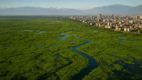

The High Court recently directed the release of funds to legal representatives to ensure the continued pursuit of accountability in the region’s wetland management crisis. This judicial intervention underscores a growing frustration with the slow pace of conservation efforts in Jammu and Kashmir, where historically significant water bodies are facing existential threats. From the sprawling expanse of Wular Lake to the vital migratory corridors of Hokersar, these ecosystems function as the biological kidneys of the valley, filtering pollutants and managing hydrological surges. Despite their designation as Ramsar sites of international importance, the gap between official status and on-the-ground reality has widened significantly. Rampant siltation, combined with the unchecked discharge of untreated sewage, has transformed these once-pristine basins into stagnant marshes. The court’s move to secure legal oversight reflects a desperate need to bypass bureaucratic inertia that has long plagued environmental governance in the region, signaling that the era of passive observation has ended.
Institutional Barriers to Effective Conservation
Administrative Gaps: The Oversight Challenge
The primary hurdle in restoring these vital landscapes lies in the fragmented nature of administrative oversight, where multiple agencies often work at cross-purposes rather than in unison. While the J&K Wetland Authority was established to provide a unified vision, it frequently clashes with the immediate economic priorities of the Revenue Department and local municipal bodies. This jurisdictional ambiguity has allowed illegal encroachments to persist, as one department often waits for another to initiate enforcement actions that never materialize. Furthermore, the absence of a comprehensive and digitized land record system specifically for wetlands has made it difficult to identify the exact boundaries of protected areas. Without clear demarcations, private developers and local agriculturalists continue to push into the peripheries of lakes like Anchar and Manasbal. This lack of coordination is not merely a logistical inconvenience; it is a systemic failure that facilitates the gradual nibbling away of public ecological assets for private gain.
Resource Allocation: The Implementation Lag
Sustained restoration efforts are currently hampered by a significant mismatch between the ambitious goals set for the period from 2026 to 2028 and the actual technical resources deployed on the ground. Although substantial budgets are often announced in fiscal planning sessions, the disbursement and utilization of these funds remain inconsistent, leading to half-finished dredging projects and abandoned desilting operations. Modern conservation requires more than just manual labor; it necessitates the integration of high-resolution satellite imagery and real-time sensor networks to monitor water quality and volume. Currently, the regional environmental agencies lack the specialized staff required to operate advanced Geographic Information Systems (GIS) that could track encroachment in real-time. This technological deficit means that by the time damage is noticed, the ecological transition from wetland to solid land is often irreversible. To bridge this gap, investment must shift toward capacity building and the acquisition of automated monitoring tools that provide objective data for decision-makers.
Ecological Pressures and Human Impact
Urban Expansion: Threatening Natural Sinks
The rapid expansion of urban centers like Srinagar and Baramulla has placed an unprecedented strain on the natural drainage systems provided by local marshlands. Historically, these wetlands acted as natural sponges, absorbing the excess runoff from the Himalayan foothills and preventing the devastating inundation of residential areas. However, as the demand for housing and commercial space increases, these low-lying areas are increasingly viewed as prime real estate rather than critical infrastructure. The conversion of the Narkara wetland and the shrinking of the Brari Nambal lagoon serve as stark examples of how short-term urban development is prioritized over long-term climate resilience. This trend is exacerbated by the dumping of construction debris and solid waste, which raises the bed level of the lakes and reduces their water-holding capacity. When these natural buffers are lost, the city becomes significantly more vulnerable to flash floods, turning every heavy rainfall into a potential humanitarian disaster for the surrounding population.
Strategic Pathways: The Road Ahead
Looking back at the most recent attempts to rectify these failures, it became clear that a shift toward decentralized, community-led management offered the most viable path forward. Local stakeholders were empowered to act as guardians of their immediate environments, bridging the gap that centralized authorities could not fill. Authorities integrated mandatory environmental impact assessments for every project adjacent to a water body, ensuring that no development proceeded without a verified mitigation plan. The implementation of strict “no-build” zones, enforced through periodic aerial surveillance, provided the necessary deterrent against further encroachment. Experts recommended the immediate adoption of biological filtration systems, such as artificial floating islands, to treat sewage at the source before it reached the main basins. These proactive measures prioritized the restoration of the natural hydrological cycle over cosmetic improvements. Ultimately, the survival of the region’s wetlands depended on a combination of rigorous legal accountability and a technical overhaul of the existing conservation infrastructure.